How UAV Mapping Is Transforming Environmental Rehabilitation
Environmental rehabilitation has entered a new era of precision and efficiency with UAV (drone) technology. By capturing high-resolution aerial imagery and generating detailed maps, Green Mines Australia helps monitor vegetation growth, track progress over time, and ensure compliance with rehabilitation standards.
The Evolution of Environmental Monitoring
In the past, monitoring environmental rehabilitation meant sending teams into the field with GPS devices, clipboards, and cameras. These manual methods were slow, labour-intensive, and often limited to small sample areas. Satellite imagery improved the view from above but lacked the resolution and frequency needed for accurate site assessment.
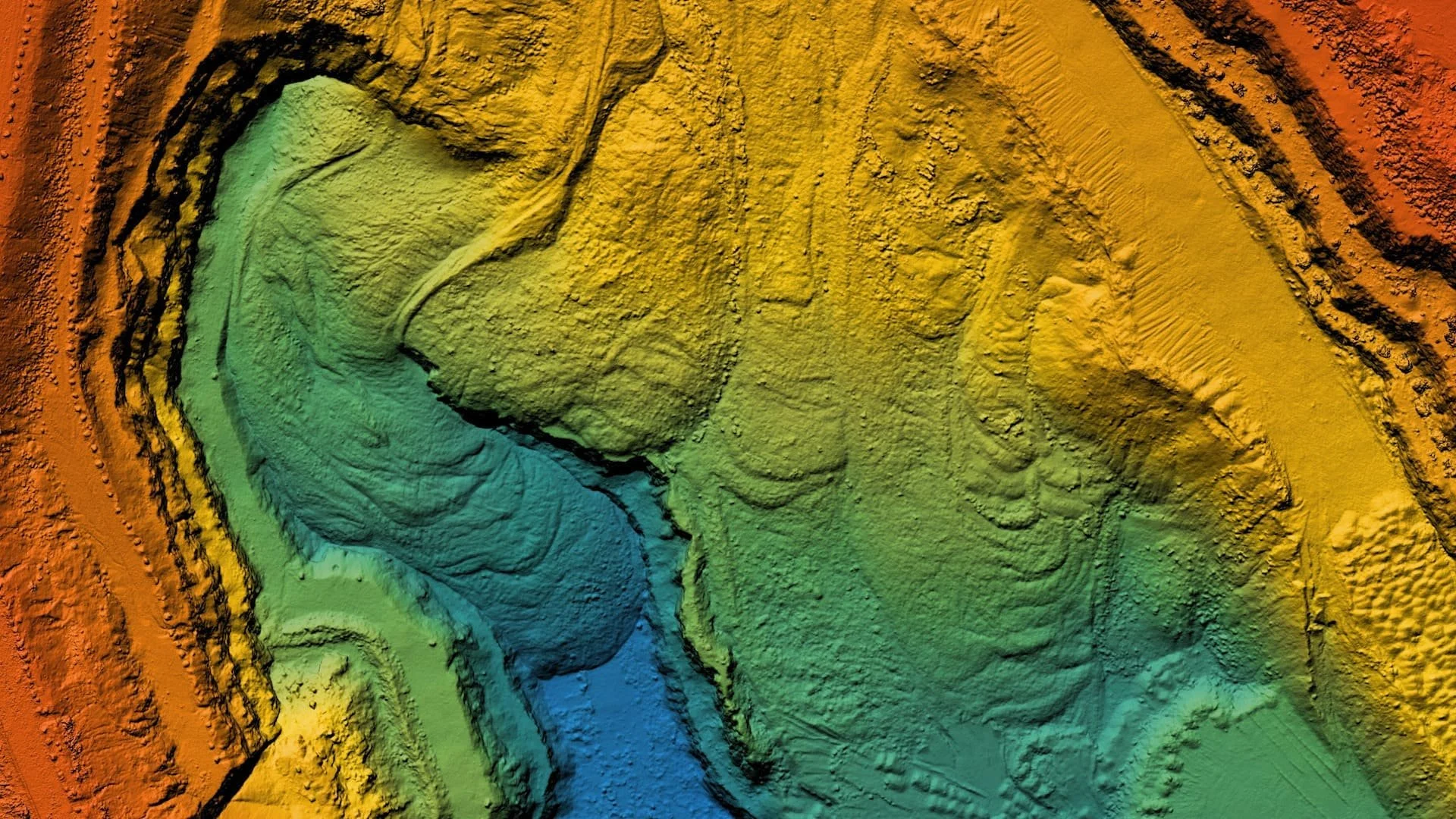
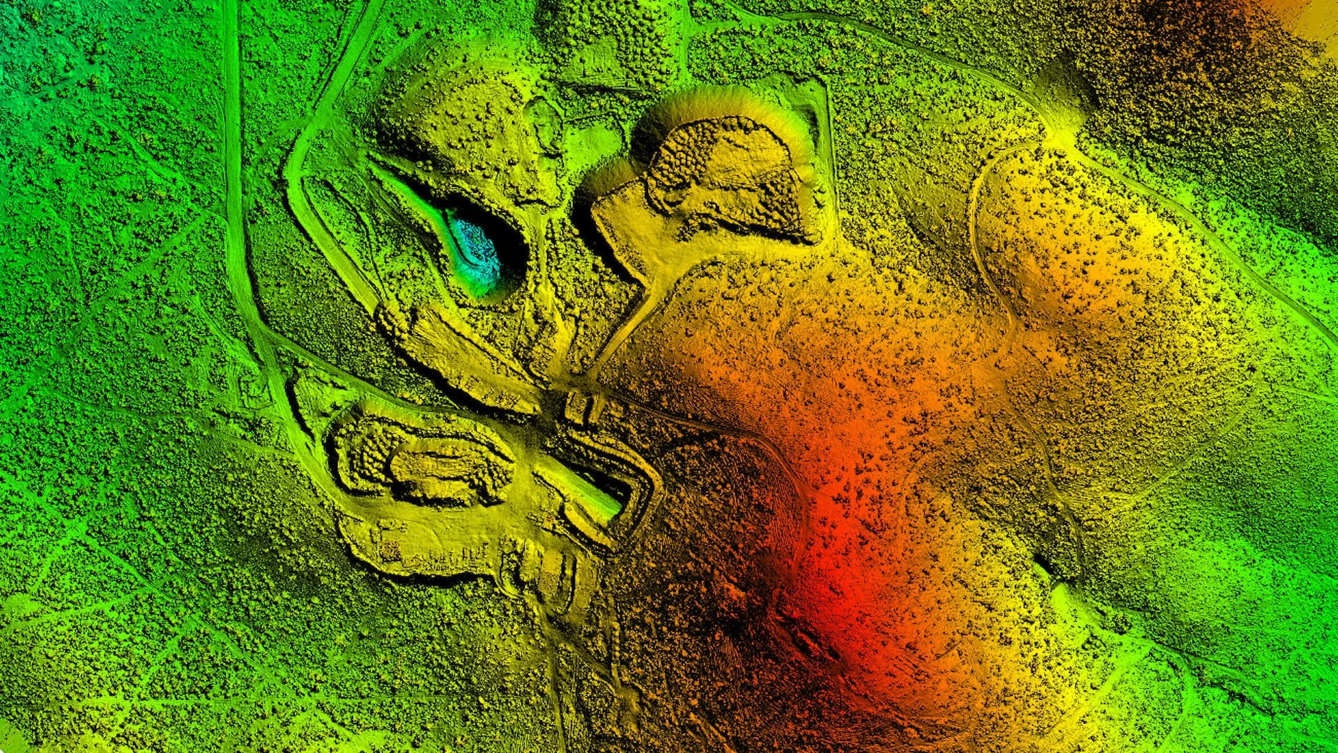
UAV mapping has changed everything. Using drones equipped with advanced sensors, large and remote areas can now be mapped in a fraction of the time, with centimetre-level accuracy. This innovation has redefined how mining and environmental projects across Australia are planned, monitored, and reported — providing the kind of data that was once impossible to collect efficiently.
The Benefits of UAV Mapping
1. Speed and Efficiency
UAVs can survey vast areas in hours, not days. Data that once took weeks to collect and process is now available almost instantly, allowing project teams to make informed decisions quickly. Regular UAV flights also make it easier to track rehabilitation progress over time.
2. Safety and Accessibility
Drone mapping removes the need for personnel to enter unstable or hazardous areas such as steep slopes, tailings dams, or post-mining pits. This not only reduces risk but also ensures more comprehensive data collection across previously inaccessible terrain.
3. Accuracy and Data Quality
UAVs deliver high-resolution aerial imagery and generate precise 3D terrain models, orthomosaics, and vegetation indices (like NDVI). These tools enable accurate analysis of vegetation health, erosion, and soil stability — giving clear, measurable insights into site recovery.
4. Cost-effectiveness
Compared to traditional aerial surveys or extensive on-ground monitoring, drone mapping offers a faster and more affordable solution. The combination of accuracy and efficiency translates directly into better resource allocation and reduced environmental management costs.

Real-World Applications in Rehabilitation Projects
At Green Mines Australia, UAV mapping plays a critical role in multiple stages of mine site rehabilitation:
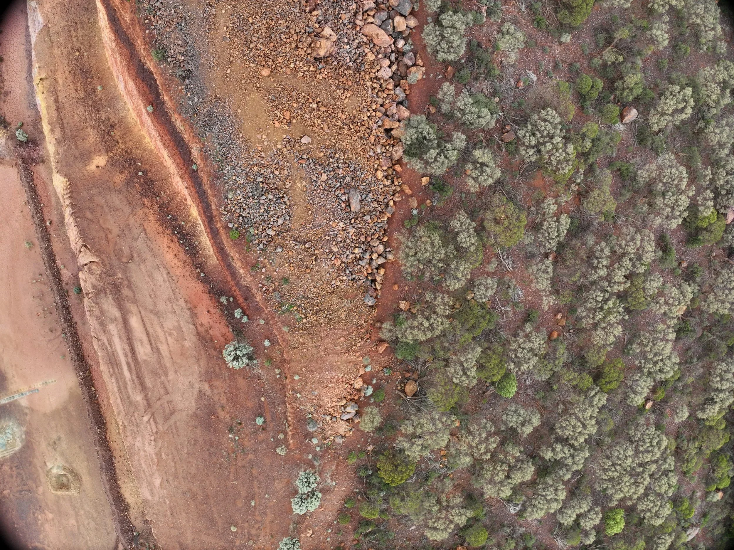
Vegetation Monitoring: Tracking plant growth and species diversity to ensure revegetation targets are met.
Erosion Detection: Identifying problem areas before they worsen, supporting timely soil stabilization and drainage improvements.
Exploration Drill Pad Remediation: Capturing before-and-after imagery to document successful rehabilitation of disturbed areas.
Material Management: Mapping soil and overburden placement to ensure even coverage and compliance with environmental standards.
These applications not only enhance operational outcomes but also demonstrate measurable progress toward sustainability goals.
From Data to Decisions: Supporting Compliance and Sustainability
Environmental compliance requires transparency and verifiable data — and UAV mapping delivers both. The detailed imagery and 3D models captured by drones are used in compliance reports, progress audits, and environmental submissions to authorities.
By integrating UAV data into GIS platforms, Green Mines Australia helps clients visualize trends, assess rehabilitation effectiveness, and ensure alignment with government and EPA requirements. This data-driven approach promotes accountability, sustainability, and continuous improvement across all stages of mine site rehabilitation.
The Future of Drone Technology in Mine Management
Drone technology continues to evolve rapidly. The future of mine rehabilitation lies in AI-assisted vegetation analysis, LiDAR mapping, and autonomous flight missions capable of collecting consistent data over long periods.
These innovations will further improve accuracy, reduce manual intervention, and allow predictive environmental modelling — identifying erosion risks, vegetation stress, or drainage issues before they become visible to the human eye.
At Green Mines Australia, we’re committed to staying at the forefront of these advancements, ensuring every project benefits from the latest in UAV mapping and environmental monitoring technology.
Conclusion
UAV mapping has become a cornerstone of modern environmental rehabilitation — offering a safer, faster, and more accurate way to assess, monitor, and restore mined landscapes. By combining technology with environmental expertise, Green Mines Australia is helping transform how mine sites are managed across the country.